
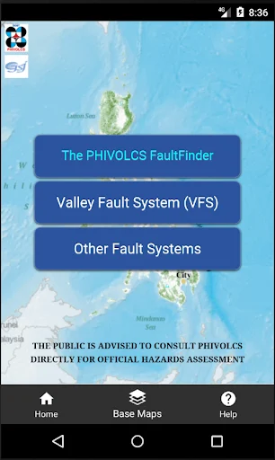
The PHIVOLCS FaultFinder
The PHIVOLCS FaultFinder is a mapping utility that shows how close a chosen location is to active fault lines in the Philippines, helping residents, planners, and builders assess earthquake risk.
screenshot
Information of The PHIVOLCS FaultFinder

Information About The PHIVOLCS FaultFinder APK
The PHIVOLCS FaultFinder is a public safety mapping application designed to help people in the Philippines understand how close a specific location is to known active fault lines. It is built for everyday users, homeowners, students, engineers, planners, and local officials who want clear information about earthquake-related risks around homes, schools, and workplaces.
The main purpose of The PHIVOLCS FaultFinder is awareness. Earthquakes are part of life in the Philippines, yet fault locations often feel abstract or technical. This application turns scientific fault data into readable maps, making it easier for people to check locations and make informed decisions about land use and safety planning.
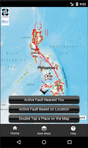
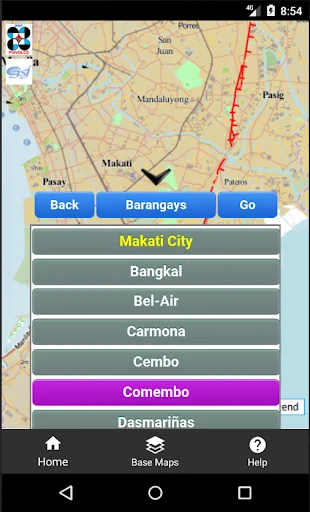
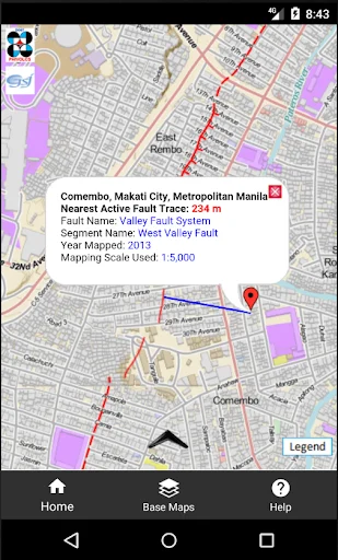
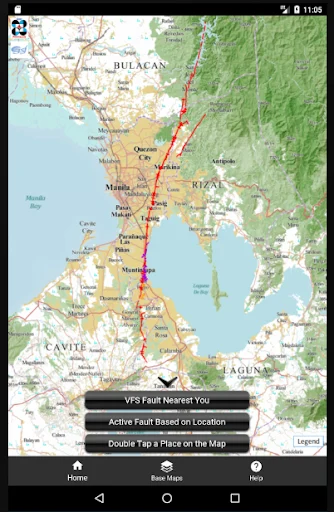
The way it works is simple. Users can enter an address, drop a pin on the map, or rely on GPS to check their current position. The system then calculates the distance from that point to the nearest mapped active fault, presenting the result directly on the screen with visual context.
Several map options are available to help users see locations clearly. The application supports different base maps, including government mapping data and widely used global maps, allowing users to compare views and better understand terrain, boundaries, and fault traces.
Its features focus on clarity and accuracy rather than complexity. Distance measurements update in real time, fault lines are sourced from official PHIVOLCS datasets, and the interface stays lightweight so even non-technical users can navigate it without confusion.
The PHIVOLCS FaultFinder is often used as a reference tool for early planning rather than prediction. It does not forecast earthquakes, but it helps users recognize whether an area lies near a fault zone, supporting smarter decisions before building, buying property, or organizing community preparedness efforts.
To check fault proximity with verified data, download the official version through APKJaka today and keep The PHIVOLCS FaultFinder as a reliable reference for location-based earthquake awareness.
Frequently Asked Questions The PHIVOLCS FaultFinder
-
What is The PHIVOLCS FaultFinder?
The PHIVOLCS FaultFinder is a mapping application that shows how close a selected location is to active fault lines in the Philippines using official geological data. -
What is The PHIVOLCS FaultFinder APK?
The PHIVOLCS FaultFinder APK is the installation file used on Android devices to set up the application and access its fault distance checking features. -
Does The PHIVOLCS FaultFinder predict earthquakes?
No. It does not forecast earthquakes or timing. It only provides location-based information about known active faults. -
Who should use The PHIVOLCS FaultFinder?
Homeowners, students, engineers, planners, teachers, and local officials use it to understand fault proximity before making location-related decisions. -
Is the data in The PHIVOLCS FaultFinder reliable?
Yes. The fault information comes from PHIVOLCS and partner scientific institutions, ensuring accuracy based on current mapped fault data.